Ordnance Survey releases open dataset and free map of Britain’s Greenspaces
Date published: 10 July 2017
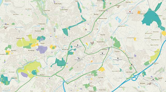
A Government initiative to make it easier for people to locate and access greenspaces has launched today with the release of a new database and interactive digital map identifying accessible recreational and leisure greenspace in Great Britain.
Delivered by Ordnance Survey (OS), the free map contains data from OS and other sources, and can be used immediately, for free, through the popular leisure mapping app and online service, OS Maps. This comprehensive map of Great Britain’s greenspaces is also available as an open dataset, called OS Open Greenspace, for communities, businesses and developers to create products and services that will encourage healthier and greener lifestyles.
OS CEO, Nigel Clifford, said: “Geospatial data can transform Governments, businesses and communities for the better. We see that through our work in Great Britain and internationally, and we’re excited to be one of those at the forefront leading this and making contributions of consequence and benefit.
"I’m particularly proud of this product as it delivers valuable information to the public, via OS Maps, enabling people and families across Great Britain to discover the greenspaces near them. In addition to this, we’re also releasing OS Open Greenspace, providing a freely available dataset for anyone to access.
"I am excited to see how people experiment and work with the data and look forward to seeing new products and services to help encourage an active Great Britain.”
Since the Greenspace map was reaffirmed as a commitment in 2015, OS has worked in collaboration with a large number of Non-Government Organisations and Government partners to compile the OS Open Greenspace dataset and digital map. Accurately depicted within the dataset is the location and extent of recreational and leisure features and, for larger sites, their access points. Example features included in the data is every public park in Great Britain, every play space, playing field, golf course, public garden, bowling green, allotment and more.
The dataset is available from OS via:
Do you have a story for us?
Let us know by emailing news@rochdaleonline.co.uk
All contact will be treated in confidence.
Most Viewed News Stories
To contact the Rochdale Online news desk, email news@rochdaleonline.co.uk or visit our news submission page.
To get the latest news on your desktop or mobile, follow Rochdale Online on Twitter and Facebook.


